Chrismar Maps
Algonquin Provincial Park 2 Northwest Map
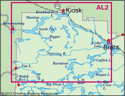
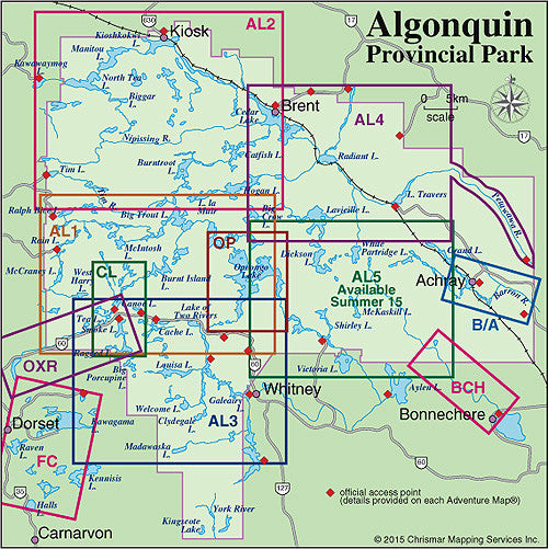
NEW VERSION! Formally at 1:80,000 scale, this new version has been Super-Sized up to 1:60,000 scale, meaning features are larger and easier than ever to read. The entire Northwest quadrant of Algonquin is covered on this the third in the main Algonquin series (4th of 5 complete, 5th coming soon). It overlaps the north edge of Algonquin 1-Corridor North and stretches from Kawawaymog Lake outside the west park boundary all the way over to Brent on Cedar Lake.
This map shows much more detail than government topos including campsites, portages, historic features and the incredibly detailed land and waterscape you've come to expect from The Adventure Map®. The back side is covered with color photos and text detailing the natural and human history of the area along with suggested routes, safety tips, contact info and much more. As with other Algonquin maps in the series this one has quickly become the standard for on-the-water navigation. Waterproof.
Algonquin 2-Northwest - ISBN: 0-929140-14-1
This map overlaps along its south edge with our popular Algonquin 1-Corridor North map, and, along its east edge, our Algonquin 4-Central North map. Also consider our smaller size, larger-scale, more detailed Algonquin "daytripper" Map guides of smaller size but larger scale, more detailed areas (Canoe Lake, Opeongo Lake, Oxtongue River, Bonnechere River and Barron-Achray) suitable for short trips of a week or less.