Chrismar Maps
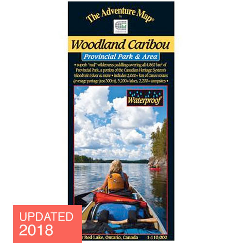
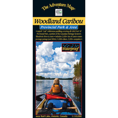
Woodland Caribou Provincial Park & Area Map
Updated 2018 Official Map. Canoe Routes, Portages, Park information and More!
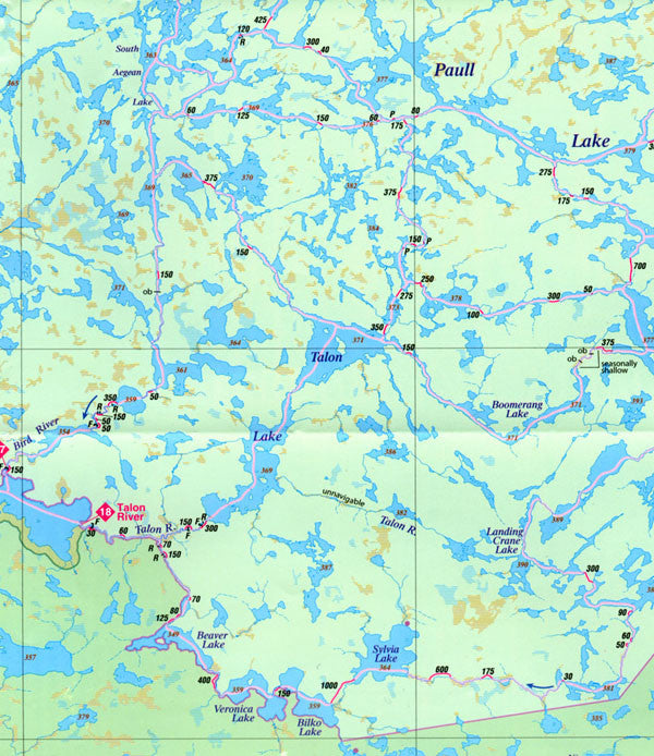
Published by Chismar Mapping services in conjunction with the Ministry of Natural Resources this official park map highlights over 4,000 square kilometers of scenic lakes, rushing and meandering streams, roaring rapids and waterfalls, punctuated by open wetlands and rocky outcrops. It's unlike most other Ontario Parks in that access is only possible by flying or paddling in. There are several access points with parking lots on the Park boundary, but no roads in the Park, so you can be guaranteed the greatest seclusion possible in today’s world.
At 1:110,000 scale our map has extraordinary geographic detail plus access points, portages, island names, lake elevations, route helpers and many other helpful features. It also covers areas outside the Park including the nearby Town of Red Lake and the huge body for which it was named. Text and color photos cover the entire backside of this 91x66cm (26x36 inch) waterproof guide (folded to 4x9 inches). You'll find information about the natural history of the area, fishing, backcountry procedures & etiquette, sample routes, detailed inset maps highlighting different areas, safety tips, contact information and much more. There is even a reference system to the major lakes - we've surveyed over 5,200 for this map - as well as 392 portages, 34 falls, and over 7,840 islands. Waterproof.
What's New for 2018: Several portages have been updated, a few corrections made and a new route added to North Prairie-Constellation lakes.
Woodland Caribou - ISBN: 0-929140-42-7